
Surveys & Stakeouts
Topography Surveys
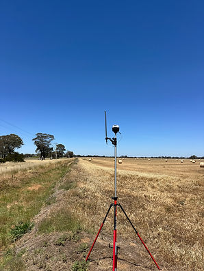
We provide comprehensive topographic surveys using state-of-the-art GNSS equipment to accurately map the contours and features of your land. By capturing every elevation change, natural formation, and man-made structure, we deliver the detailed, precise data you need for effective project planning and decision-making. With our topographic surveys, you’ll gain a clear understanding of your property’s unique characteristics, ensuring that every aspect of your development is based on reliable, up-to-date information.
Stakeouts
Our stake out services translate topographic data into practical on-site guidance. By marking precise points and boundaries on the ground, we give you a clear visual reference for construction, landscaping, and other land development activities. Whether it’s defining building footprints or service lines, our accurate stake outs ensure you’re ready for seamless, efficient execution in the field.
Work as Executed
Once your project is completed, our work as executed (WAE) surveys verify that all structures, features, and improvements have been constructed according to plan. This final step offers a record of what’s been built, identifying any deviations from original designs and confirming compliance with regulatory requirements. By providing an accurate snapshot of finished works, our WAE surveys support long-term asset management, maintenance planning, and proof of compliance.
